Thursday, July 7, 2016

Cassiar Highway

Well, as promised, this is where the real adventure begins.  Southern BC is beautiful, but it's pretty civilized compared to the far western reaches of the province.  Leaving Kitwanga (which is a lot of fun to say if you do it like a sound effect) we really started to see why the license plates for this province say "Beautiful British Columbia."  We stopped for photos quite often along the Cassiar (Canada Highway 37), but we overnighted in Stewart and Iskut.

Stewart is a small port town on a fjord that projects up all the way from the Pacific.  It's at the end of highway 37A, which considering how remote it is, was a very nice road.  Along the way, you come around a corner and are greeted with the sight of Bear Glacier, just across a lake from the road.  We've seen so many black bears now, I can't remember if we saw one on this spur or not.  We have seen black bears, a huge bobcat the size of a Labrador retriever, bald eagles, and a moose.  This was all on the Cassiar at some point.  Back to Stewart.  It's a cool little town on the Alaska border, back in there where Alaska forms the coastline.  The US town of Hyder, AK is right there with it, and you drive through Hyder to get to the coolest thing we've seen so far, the Salmon Glacier.  The drive up to the Salmon Glacier is on a working gravel road up into the mountains, a little steep and winding but man worth the trip.  We spent 2 nights at the Bear Creek Campground in Stewart, very nice.

The next day we continued north to Mountain Shadow RV Park in Iskut.  Iskut is a whistle stop, but the campground is a slice of heaven.  They had good satellite WiFi, so we spent a couple days chilling out and I got a lot of school work done on our down day.  We didn't go anywhere, just hung out and relaxed/worked.  It was great.  The bald eagles were flying around the whole time we were there.  We made some new friends at an impromptu jam session at our campsite.  Sunset isn't until around 11pm here, so there's plenty of time after dinner for sitting around gabbing.  Which way you headed?  How were the roads?  What'd you do for fun?  This community of nomads we belong to is a hoot.

The road condition deteriorated a bit the further we got up the Cassiar, but it's still pretty good, you just have to take your time through the gravel.  A little trivia I didn't know, BC mines like 90% of the jade in the Cassiar Mountains.  We stopped at Jade City, where the family that does most of the mining has a store, and bought a couple pieces.  I got a raw piece about the size of a smart phone for $5 that I'd like to have made into something.  They mine 100 tons a year in huge boulders and export half of it.  You could have jade counter tops if you were so inclined.

We drove through miles of territory that had burned pretty bad in forest fires in 2010 and 11, but for the most part this area is just incredibly densely forested.  I wonder what the total value of the usable timber in BC is.  It's got to be kajillions of dollars.

As I type, we've made it to the end of the Cassiar Highway and are in Watson Lake, Yukon Territory!  Here are some pictures...

Oh, I left this out last update.  This is PG, the mascot of Prince George, BC where we spent Canada Day.

The world's largest fly rod, Houston BC.

One of our short side trips off the Cassiar, Gitanyow BC.  Its claim to fame is totem poles, dozens of them.

I guess I just thought this was an awesome view.  It was generally very cloudy close to the coast, just the kind of Pacific Northwest weather you'd think would be there.  

Bear Glacier, from the road leading to Stewart.

You have to cross into Alaska on your way from Stewart to the Salmon Glacier.  This does not count toward the Alaska sticker for the RV.  We took the Chevy, so it doesn't count.  Interesting little town though, so remote.

This is the Salmon River, pretty much totally fed by the melt water from the Salmon Glacier.  Looking back down the valley from the road up to the glacier.

Click on this one.  As I'm always saying, the pictures just don't do these view justice.  At the top of the picture, it looks like the glacier is coming from the valley up and to the left.  It is.

Here we are at the end of the line.  Only work trucks extending the power lines are allowed further up the valley.  The Salmon Glacier is about 500 feet thick and goes on for about 12 miles before it turns into the ice field up in the mountains.

Same view, but panoramic.

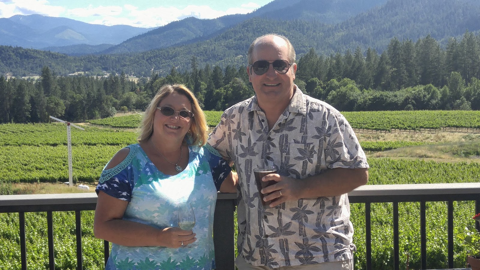
Mountain Shadow RV Park jam session.  We were pretty chilly, huddled around our propane fire pit and wearing jackets.  This picture was taken at 9pm, and we kept going in total daylight for another couple hours. I could read my songbook with no extra light all night.

Down the hill from the RV spots at Mountain Shadow, they own lakefront property.  This is where the bald eagles were flying and fishing while we were there.

Jade City, just a "tourist trap" on the Cassiar Highway.  We spent, ahem, saved some money here.

Saturday, July 2, 2016

Southern BC (British Columbia)

We left the Columbia River Gorge and headed north on a mission.  We didn't stop for any sight seeing in Washington, because it's time to stop dilly dallying.  So, we camped at a cool little overnight municipal campground in Omak, WA so we could make "one last Walmart run" before heading into Canada.  Funny, because I've probably seen half a dozen Walmarts in Canada.  Anyway, the border crossing was uneventful.  We talked to the border guard, nice young man, for probably 5 minutes while the computer ran a background check on us or whatever it does.  He was mostly concerned about guns.  With us being from Florida, the assumption is you're packing.  He even asked if I had a concealed permit.  He also asked about fresh fruits and vegetables, but it was a very low threat entry into the friendliest "foreign" country in the world.  Our first stop was in BC's 2nd largest city, Kelowna.  It's not far across the border, and is a very nice tourist town on Okanagan Lake.  We stayed for a couple nights to get our bearings, then headed up highway 97 to the next town, Williams Lake.  They have a nice campground on their dedicated rodeo (stampede) grounds.  The stampede was the coming weekend, but again, no dilly dallying.  We spent one night at the campground, looked around town some, then moved on to a couple nights in the next good sized town, Prince George.  This is a college town, again, with all the comforts of home.  We were lucky enough to celebrate Canada Day in Prince George.  It was a very multi-cultural affair, and in a beautiful park.  There's a distinct lack of junkiness that you see in American rural areas.  So far, BC has been no more remote than any place out west in the states, in some ways less remote.  So far, that is.  As I type, we're in Kitwanga, BC which is pretty far west and getting to be pretty north.  We've got a 450 mile trip up the Cassiar Highway to get to the Yukon Territory, but I think this is where the trip really starts.  We saw towering snow capped peaks coming into town, and the rivers are getting bigger and wilder.  We did see a bear running across the highway just in front of us today, which was cool.  Laurie saw a deer as well, but the many moose warning signs have, so far, been for naught.  One thing I am noticing is a lack of "scenic overlooks."  We've seen a lot of very pretty vistas, but I guess there are so many that the highway department here doesn't make a habit out of scenic view pull offs.  The rest areas are routinely placed in great locations, like on a lake or stream, however.  Here are some pictures so far:

Woohoo, welcome to BC!  I'm going to have to buy the Canadian provinces sticker map for the RV now.

Lunch view on Okanagan Lake.  We had really warm weather the past week or so, glad it's finally cooling off.

This is very typical of the rest areas in BC.  They choose a nice looking spot where the highway passes a stream or lake and make a wide spot.  Voila, ham and cheese sandwiches with a million dollar view.

These guys were in a pen getting ready for the upcoming weekend's annual "stampede."  I'm thinking that's just Canadian for "rodeo."  Anyway, their paddock was way over grazed so I offered them some of the fat green grass just outside the fence.  Hmm, who wants to be my favorite horse?   Kidding, I gave several a handful so there wouldn't be any fuss.

Wider view of the paddock with the seating area for the stadium in the back.  About 2 hours after I took this photo, we got pea sized hail for about 5 minutes.  Laurie and I were watching the show out the front window of the motorhome, they were all stampeding trying to get away from the hail.

Yeah, our motorhome next to the Canadian flag.

This was our campground "office" in Prince George.  It was a simple affair, $12 a night for a full hook up, and the owner was great.

The Canada Day (July 1st) celebration in Prince George.  We forgot our chairs, so we just walked around goofing on all the proud Canadians.  These are the friendliest people in the world.  And I've been everywhere so I know...

Me with two Royal Canadian Mounted Police.  How cool is that?  I grew up with Dudley Do Right as one of the Saturday morning cartoons, so I had to get a picture.

Typical proud Canadians.

Tuesday, June 28, 2016

Oregon

Oregon has become our favorite place out west.  We retraced our previous steps, this time from south to north.  Our first stop was a great little state park on the Rogue River, appropriately named Valley of the Rogue State Park.  Laurie found an open site on a weekend, huge luck for us which must have been because of a last minute cancellation.  The park is right off I-5 and our campsite overlooked the river.  We spent a couple nights there then moved on to McMinville, northwest of the state capitol in Salem.  The main attraction there, other than it just being beautiful and cool, is the Evergreen Air and Space Museum, home of Howard Hughes' Spruce Goose.  The flying boat from the '40s is still the largest aircraft to take flight.  They moved it from Long Beach, CA to central Oregon back in the 90's using barges.  It's just huge, you have to see it.  And though it's mostly birch and not spruce, it is virtually all laminated wood.  Our first night in the McMinville area, we tried a new form of camping.  We stayed at a winery up in the hills, as part of our new membership in Harvest Hosts.  We were treated like family and had a wonderful evening with the Kramer family at Kramer Vineyards.  The next 3 nights were at a conventional campground, really nice, next to the museum.  One of the highlights of this stay was getting to see an old military buddy from an assignment in Japan 15 years ago, Chris Molin.  After our stay in McMinville, we moved on to the Columbia River Gorge, just east of Portland.  This are is also phenomenal and we'll just have to come back.  We didn't even scratch the surface.  One of these summers we're going to spend the whole season in Oregon.  Here are some pictures:

A common view in Oregon, vineyards and mountains.

The Applegate Valley, near Medford, OR.

Laurie taking in the view on a perfect Saturday afternoon.

Intrepid travelers suffering through another dismal day of retirement.

The view from our windshield at Kramer Vineyards.

Cheers!  (Photo by Shantel, thanks!)

Chris Molin and I worked together at Misawa Air Base in Japan earlier in the century.

Hard to get it all in.  Enlarge this panorama I took and you can see the Spruce Goose and how large it is compared to all the other planes and objects in the museum.

Your's truly enjoying a beautiful calm day in the Columbia River Gorge.

This is Horsetail Falls.  Like I'm always saying, the pictures don't do it justice.  It's around 175 feet high, but you can't really get a sense of the beauty from a photo.  You just have to see this stuff.  The most popular waterfalls in the gorge were packed.  There's one over 600 feet, but we couldn't get a parking spot near it.  That's what you get for being anywhere popular on a weekend.

Mount Hood.  If you drive south up and out of the gorge, you see these Cascade Mountain giants.

Thursday, June 16, 2016

San Francisco

After Santa Cruz, we had another interesting drive through another major metropolitan area to get past.  I hate driving in big cities.  Everybody's in such a big hurry, traffic often backs up long before your exit and makes you have to cram in at the last minute, stop and go, people on their cell phones.  Yuck.  Boo hoo for me, right?  We skirted the San Francisco area as much as possible, going east through Oakland before crossing back over to I-5 in Sausalito.  Once we got back on I-5, everything was gravy.  We stayed just north of the bay area in Novato, CA.  It's a cool little town with all the comforts of home, but none of the mayhem of LA or San Francisco.  During our usual 3 day stay, we took the ferry from Sausalito over to the San Francisco waterfront.  We had intended to ride a cable car, but on a sunny Sunday afternoon, it was more like the line for Space Mountain at Disney.  We saw a cable car at least, but didn't ride one.  The waterfront area by Fisherman's Wharf was packed with activity, music, food, craziness.  There was a "pride" event in town as well, so that's how it goes.  Overall, it was windy, cold, loud, crowded and expensive.  Only a couple pictures...

Alcatraz from the ferry


Monday, June 13, 2016

Santa Cruz

In the summer of 2013, we stayed a week in Monterrey at the Naval Post Graduate School's campground.  It was a beautiful town, and we wanted to see the town at the other end of Monterrey Bay, so this time we stayed in Santa Cruz in a cool little RV park at the harbor.  We were looking out our windshield at the boat slips.  While we were there, we drove over the coast mountain road, 117, into San Jose for the day.  What a drive, like a racetrack.  We toured the Winchester House on one day, then checked out the sights around Santa Cruz the next.  With only three nights, we didn't get to see a whole lot, but it was very nice.

There's an old school boardwalk and pier in Santa Cruz.  A little touristy, but fun for a walk.

The sea lions were out in force.  They were laying all over the sub structure of the pier, and here's a big group just resting in the water.

Hard to tell, but these are sea otters.  We saw them for the first time this trip.

The Winchester House.  This is the one the lady kept building on willy nilly until she died.  It was sold and turned into a private museum right after her death and they've been doing tours ever since.

The front of Winchester House.  This door and view is probably the least crazy area of the house.

The California Surf Museum.  Really nice views of the coast from up here, not so much information on surfing.

We had lunch at a dog friendly cafe.  This friendly dog became my new best friend.  Don't mind Laurie's finger in the foreground.

I took this panoramic view of Santa Cruz Harbor from the roof of the motorhome.  Very nice view for a few days.  The houses on the hill overlooking the same view cost millions.

Another view of Santa Cruz Harbor from the railroad bridge.

Wednesday, June 8, 2016

Oceanside, CA

Wow, what a difference a day's drive can make.  It was a hair raising (and I only have 3 hairs on top) drive through the outskirts of LA down to our beachfront reservation on Camp Pendleton, just north of Oceanside.  We had stayed here in summer of 2013 before heading back east.  It's beautiful.  There's just a ton of traffic no matter what you do, but we got down there with no drama.  Besides hanging out on the beach, strumming guitar by the campfire and such, we got to visit with old friends Mike and Jama.  They moved to Oceanside since we visited in 2013.  We go way back, and haven't seen them since our visit to Mountain City, TN back in 2012.  We forgot to take any pictures with them, unbelievable.  In addition to grilling burgers with us on the beach, they hosted us at their house in the hills for steaks on grill.  I had been nursing a slow leak in one of the tires on the Equinox we tow, and I took it to Discount Tires and they found a screw and repaired it for free.  Hard to beat that.  All in all, it was another great week on the beach in SOCAL.  Here are some pictures:

The obligatory windshield view.  There's just something totally cool looking at the ocean while you're sitting on your couch having your morning coffee.  A view like this would be several million dollars in this neck of the woods.  I'll take it for $40 a night, thank you.

Mike and Jama took us to neighboring Carlsbad, CA for a walk along the beach on their fitness trail.  It goes on for a long way, overlooking the usual southern California beach scene of surfers, volleyball courts and families just enjoying the day.

I was beginning to wonder if the Marines would put on one of their parades.  The morning we were heading out, they didn't disappoint.  Here they are in their amphibious armored personnel carriers, heading past the campground and out to the exercise area.  Pendleton is enormous, and they practice doing all kinds of Marine Corps stuff out there.  I'm just glad they carved out a piece of beach for recreation.

Jama took Laurie out for a girl's day, and Laurie snapped this perfect rose picture.  It seems plants grow like crazy out here if you only water them.  That's the rub though, not a lot of water to go around.

Wednesday, June 1, 2016

Ehrenberg, AZ

When you're making miles on the interstate, you often pass little towns with nothing much to notice but a truck stop and a greasy spoon.  Laurie and I have found many times that if you stop and check it out, these little towns often have hidden treasures.  Ehrenberg was like that for us.  We stayed 4 nights over Memorial Day weekend and it was great.  We toured Joshua Tree National Park, hung out by the pool, went out for pizza and music, and of course relaxed in the high desert coolness.  I never paid attention until Laurie got a telescope for Christmas last year, but the planets are really visible in the evening sky lately.  We stargazed at Mars on the night of its closest approach, as well as Jupiter and checking out the rings of Saturn.  It's really clear and dark in the middle of nowhere!  Here are some pictures:

Some restaurants collect dollar bills written on them and stapled all over the place to commemorate your visit.  I've seen others that do the same thing with bras.  At the River Run Cafe in Ehrenberg, it's flip flops.  This looks like an upside down view of the floor, but it's the ceiling over my head.

The Mighty Endeavor viewed from poolside at the Arizona Oasis RV Resort.  Hard to believe we've owned her for 5 years now, called her home for 4.  In the background, you can see the trees lining the Colorado River.  That's the big draw here on a long weekend.  The motor sports fans were zooming up and down the river all weekend, as well as putting around in their dune buggies.  Not quiet, but interesting and it's good to see working folks enjoying themselves.

Intrepid travelers at the Cottonwood entrance off I-10.  It doesn't look like much from the interstate, but it was really pretty (in a desert sort of way) once we climbed up into the mountains.  We went in the Chevy.  Touring national parks in the motorhome just isn't as much fun.

Cholla cactus


Another view of all the cactus

A Joshua Tree, found only in the Mojave Desert.  The trunk looks like an oak or something, but the top looks like a cactus.  It's actually a type of yucca, only pollinated by the yucca moth.

Panaramic view of a Joshua Tree "forest"

The view of Palm Springs and the Salton Sea from high up in JTNP.  The smog is courtesy of LA traffic.  It funnels through a pass into this valley.

The Colorado River was flowing strong when we were at the Arizona Oasis.  I took this picture Monday, after most of the boaters had gone home.

We went out for pizza at the River Run Cafe, and they had a great guitarist/singer doing all kinds of country and classic rock.  Here's a guitar solo from the 80's.  Some will love it, to others it will be NOISE